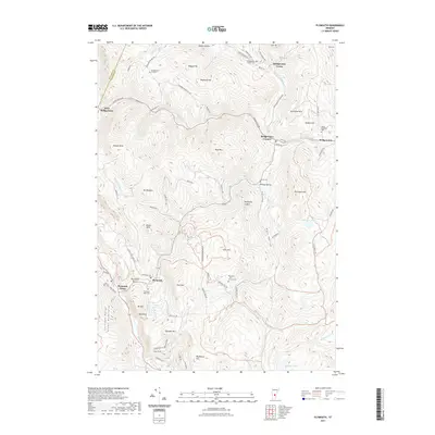
2021 Map of Plymouth
USGS Topo · Published 2021About this map
Plymouth Notch and its surrounding peaks define this mid-2020s landscape in the Green Mountains. The topography is dominated by the Coolidge Range and high points like Morgan Peak and Southgate Mtn, which frame the deep valleys of the Ottauquechee River and its branches. This survey highlights the dense network of early crossroads and rural settlements that persist in Windsor County, including Bridgewater Corners and the small hamlet of Pinney Hollow. Genealogists and local researchers will find several burial grounds documented, from the Bridgewater Hill Cem in the north to the Plymouth Notch Cem further south. The map illustrates the complex drainage patterns of the region, where water bodies like Reading Pond and Mecawee Pond sit tucked between ridges such as Soltudus Mtn and Slack Hill.
Find a feature on this map
91 named features on this map. Tap any name to fly to it.
Don’t see what you’re looking for? This feature index may not catch every label — zoom into the map to look around manually.
Map Details
Editions of this 2021 Plymouth Map
This is the sole edition of this map. No revisions or reprints were ever made.
Other maps of this area

1891 · Rutland
USGS Topo · 1:62,500

1893 · Wallingford
USGS Topo · 1:62,500

1893 · Rutland
USGS Topo · 1:62,500

1911 · Woodstock
USGS Topo · 1:62,500

1913 · Woodstock
USGS Topo · 1:62,500

1928 · Ludlow
USGS Topo · 1:48,000

1929 · Ludlow
USGS Topo · 1:62,500

1932 · Ludlow
USGS Topo · 1:62,500

1943 · Woodstock
USGS Topo · 1:62,500

1950 · Glens Falls
USGS Topo · 1:250,000