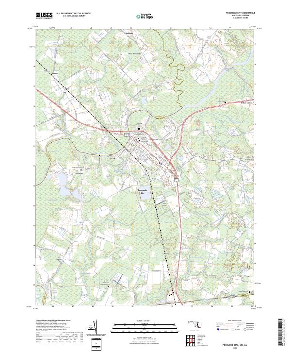
2023 Map of Pocomoke City
USGS Topo · Published 2023About this map
Pocomoke City serves as the focal point of this Eastern Shore landscape, situated where the Pocomoke River transitions through a complex network of wetlands and tidal branches. The town's historical development is evident in its street grid and the high density of religious landmarks, including Pitts Creek Presbyterian Cem, Saint Marys Episcopal Cem, and Bethany Methodist Cem. These sites, along with others like Salem Methodist Cem, highlight the deep-rooted community history of Worcester Co and its neighbors.
Find a feature on this map
121 named features on this map. Tap any name to fly to it.
Don’t see what you’re looking for? This feature index may not catch every label — zoom into the map to look around manually.
Map Details
Editions of this 2023 Pocomoke City Map
This is the sole edition of this map. No revisions or reprints were ever made.
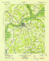
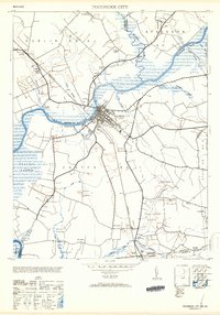
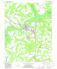
Historical Maps of Puncheon Landing Through Time
4 maps found