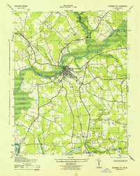
1943 Map of Pocomoke City
USGS Topo · Published 1943About this map
Pocomoke City serves as the central hub of this 1943 survey, situated along the Pocomoke River where it crosses the Somerset and Worcester County line. The map captures a landscape defined by an intricate network of waterways and wetlands, including the expansive Cypress Swamp and Beaverdam Swamp. Settlement patterns follow the higher ground between these drainages, marked by rural congregations such as Tindlys Chapel, Cokesbury Church, and Quinton Church.
Find a feature on this map
47 named features on this map. Tap any name to fly to it.
Don’t see what you’re looking for? This feature index may not catch every label — zoom into the map to look around manually.
Map Details
Editions of this 1943 Pocomoke City Map
This is the sole edition of this map. No revisions or reprints were ever made.
Other maps of this area

1901 · Snow Hill
USGS Topo · 1:62,500

1942 · Kingston
USGS Topo · 1:24,000

1942 · Princess Anne
USGS Topo · 1:24,000

1942 · Snow Hill
USGS Topo · 1:24,000

1942 · Saxis
USGS Topo · 1:24,000

1942 · Dividing Creek
USGS Topo · 1:24,000

1943 · Snow Hill
USGS Topo · 1:31,680

1943 · Dividing Creek
USGS Topo · 1:31,680
1943 · Princess Anne
USGS Topo · 1:31,680

1943 · Saxis
USGS Topo · 1:31,680