
1942 Map of Kingston
USGS Topo · Published 1962About this map
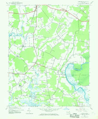
The Pocomoke River defines the eastern edge of this Somerset County landscape, where the tidal waters of the Cypress Swamp create a dense natural boundary with neighboring Worcester County. During the early 1940s, the Pennsylvania railroad line served as a primary transportation artery, connecting the settlement at Westover with outlying communities like Kingston and Marumsco.
Find a feature on this map
22 named features on this map. Tap any name to fly to it.
Don’t see what you’re looking for? This feature index may not catch every label — zoom into the map to look around manually.
Map Details
Editions of this 1942 Kingston Map
2 editions found
Other maps of this area

1903 · Crisfield
USGS Topo · 1:62,500

1903 · Deal Island
USGS Topo · 1:62,500

1920 · Crisfield
USGS Topo · 1:62,500

1942 · Marion
USGS Topo · 1:24,000

1942 · Monie
USGS Topo · 1:24,000

1942 · Princess Anne
USGS Topo · 1:24,000

1942 · Saxis
USGS Topo · 1:24,000

1942 · Dividing Creek
USGS Topo · 1:24,000

1943 · Dividing Creek
USGS Topo · 1:31,680
1943 · Princess Anne
USGS Topo · 1:31,680