Loading...
Loading map...2022 Map of Point Comfort
USGS Topo · Published 2022About this map
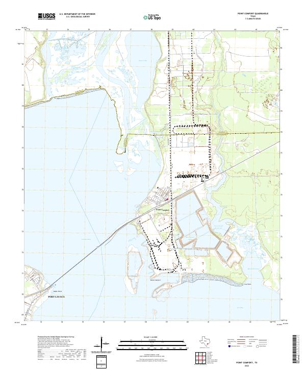
The industrial and coastal landscape of Calhoun County is defined by the extensive water management systems surrounding Point Comfort. Large industrial basins such as Raw Water Lake, Storm Lake, and Clear Lake dominate the central peninsula, supporting the area's economic infrastructure. To the east, the Coxs Creek Reservoir and the winding course of Cox Cr demonstrate the modification of the natural hydrology for modern utility.
Find a feature on this map
39 named features on this map. Tap any name to fly to it.
Don’t see what you’re looking for? This feature index may not catch every label — zoom into the map to look around manually.
Map Details
Date Portrayed2022
Date Published2022
PublisherU.S. Geological Survey
Map TypeTopographic
Scale1:24000
Physical Dimensions24 x 29 inches
Editions of this 2022 Point Comfort Map
This is the sole edition of this map. No revisions or reprints were ever made.
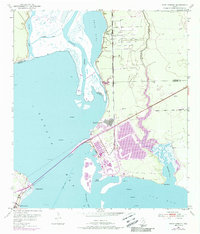
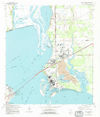
Historical Maps of Cox Point Through Time
3 maps found
Featured Locations
Source Details
SourceU.S. Geological Survey
CopyrightPublic Domain