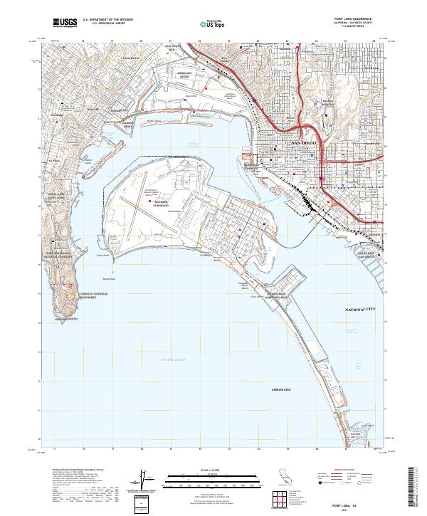
2021 Map of Point Loma
USGS Topo · Published 2021About this map
Cabrillo National Monument anchors the southern tip of the peninsula, overlooking the entrance to the harbor where the Pacific Ocean meets the complex shoreline of San Diego Bay. This modern survey details the high density of military and civic infrastructure characterizing the region, from the sprawling North Island Naval Air Station / Halsey Field to the urban grid of San Diego and Coronado. Extensive waterfront trails, such as the Bayshore Bikeway Trl and the Silver Strand State Beach Trl, trace the narrow coastal geography of the Silver Strand.
Find a feature on this map
71 named features on this map. Tap any name to fly to it.
Don’t see what you’re looking for? This feature index may not catch every label — zoom into the map to look around manually.
Map Details
Editions of this 2021 Point Loma Map
This is the sole edition of this map. No revisions or reprints were ever made.
Other maps of this area

1903 · La Jolla
USGS Topo · 1:62,500

1904 · San Diego
USGS Topo · 1:62,500

1904 · Southern California Sheet No. 2
USGS Topo · 1:250,000

1930 · La Jolla
USGS Topo · 1:62,500

1930 · San Diego
USGS Topo · 1:62,500
1942 · La Mesa
USGS Topo · 1:31,680

1942 · Point Loma
USGS Topo · 1:31,680

1943 · La Jolla
USGS Topo · 1:31,680
1943 · San Ysidro
USGS Topo · 1:31,680
1944 · National City
USGS Topo · 1:31,680