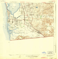
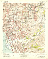
1943 Map of San Ysidro
USGS Topo · Published 1943About this map
The international border between the United States and Mexico anchor this survey, which traces the southern reaches of San Diego Bay during the height of the Second World War. The landscape is defined by the coastal transition from the Silver Strand peninsula to the inland mesas, with the Tia Juana River and Otay River carving through the terrain. Civil and military infrastructure is prominent, including multiple landing fields and the expansive Salt Works at the bay's edge.
Find a feature on this map
45 named features on this map. Tap any name to fly to it.
Don’t see what you’re looking for? This feature index may not catch every label — zoom into the map to look around manually.
Map Details
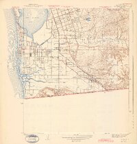
Editions of this 1943 San Ysidro Map
2 editions found
Other maps of this area

1903 · Cuyamaca
USGS Topo · 1:125,000

1904 · San Diego
USGS Topo · 1:62,500

1904 · Southern California Sheet No. 2
USGS Topo · 1:250,000

1930 · San Diego
USGS Topo · 1:62,500

1942 · Point Loma
USGS Topo · 1:31,680

1943 · Jamul
USGS Topo · 1:62,500
1944 · National City
USGS Topo · 1:31,680

1950 · San Diego
USGS Topo · 1:250,000
1953 · San Ysidro
USGS Topo · 1:24,000
1953 · National City
USGS Topo · 1:24,000