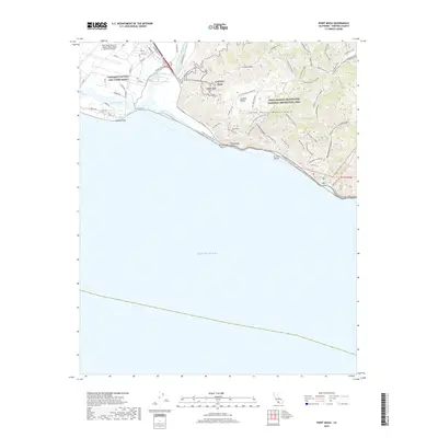
2018 Map of Point Mugu
USGS Topo · Published 2018About this map
Navbase Ventura City Point Mugu dominates the western edge of this coastal landscape, situated where Calleguas Creek and Revolon Slough feed into the complex tidal waters of Mugu Lagoon. This 2018 survey details the extensive infrastructure of the Point Mugu Naval Air Station, including the grid of runways and specialized roads such as Main Rd and Pacific Rd. Eastward, the terrain transitions sharply into the protected wilderness of the Santa Monica Mountains National Recreation Area, where high points like Laguna Peak and La Jolla Peak overlook the shoreline.
Find a feature on this map
64 named features on this map. Tap any name to fly to it.
Don’t see what you’re looking for? This feature index may not catch every label — zoom into the map to look around manually.
Map Details
Editions of this 2018 Point Mugu Map
This is the sole edition of this map. No revisions or reprints were ever made.
Other maps of this area

1900 · Triunfo Pass
USGS Topo · 1:62,500

1903 · Camulos
USGS Topo · 1:125,000

1904 · Hueneme
USGS Topo · 1:62,500

1921 · Triunfo Pass
USGS Topo · 1:62,500

1932 · Arroyo Sequit
USGS Topo · 1:24,000

1942 · Hueneme
USGS Topo · 1:62,500

1943 · Hueneme
USGS Topo · 1:62,500
1943 · Triunfo Pass
USGS Topo · 1:62,500

1949 · Los Angeles
USGS Topo · 1:250,000

1949 · Long Beach
USGS Topo · 1:250,000