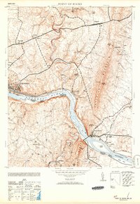
1953 Map of Point of Rocks
USGS Topo · Published 1953About this map
The Potomac River corridor serves as the central artery for this mid-century survey, defining the border between Maryland and Virginia. The landscape is dominated by the parallel transit routes of the Baltimore and Ohio railroad and the Chesapeake and Ohio Canal, which navigate the narrow passage beneath Catoctin Mountain. The bustling rail town of Brunswick stands in contrast to the agricultural settlements of Jefferson and Petersville to the north.
Find a feature on this map
31 named features on this map. Tap any name to fly to it.
Don’t see what you’re looking for? This feature index may not catch every label — zoom into the map to look around manually.
Map Details
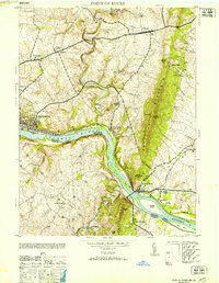
Editions of this 1953 Point of Rocks Map
2 editions found
Other maps of this area

1884 · Harpers Ferry
USGS Topo · 1:125,000

1891 · Harpers Ferry
USGS Topo · 1:125,000

1893 · Frederick
USGS Topo · 1:125,000

1893 · Harpers Ferry
USGS Topo · 1:125,000

1894 · Frederick
USGS Topo · 1:125,000

1908 · Middletown
USGS Topo · 1:48,000

1908 · Seneca
USGS Topo · 1:62,500

1908 · Ijamsville
USGS Topo · 1:62,500

1909 · Ijamsville
USGS Topo · 1:62,500

1910 · Antietam
USGS Topo · 1:62,500