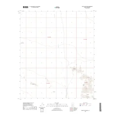
2018 Map of Point of the Pintas
USGS Topo · Published 2018About this map
The Mohawk Valley and the vast expanse of the Tule Desert define this portion of Yuma County, illustrating a landscape shaped by arid drainage patterns and isolated rocky outcrops. The presence of Mohawk Wash cutting through the northern sections provides a clear view of the seasonal watercourses that dominate the local topography. Further south, the terrain rises sharply into the jagged formations of the Sierra Pintas, where unique landmarks like the Point of the Pintas and the curiously named What Fo Canyon stand out against the desert floor. This 2018 survey by the U.S. Geological Survey details the stark geographic features such as the Devil Hills and Bean Pass, offering researchers an exact look at the natural landmarks that have historically guided travelers through this southwestern corner of Arizona.
Find a feature on this map
12 named features on this map. Tap any name to fly to it.
Don’t see what you’re looking for? This feature index may not catch every label — zoom into the map to look around manually.
Map Details
Editions of this 2018 Point of the Pintas Map
This is the sole edition of this map. No revisions or reprints were ever made.
Other maps of this area

1926 · Mohawk
USGS Topo · 1:62,500

1927 · Kim
USGS Topo · 1:62,500

1928 · Mohawk
USGS Topo · 1:62,500

1931 · Kim
USGS Topo · 1:62,500

1953 · Ajo
USGS Topo · 1:250,000

1957 · Ajo
USGS Topo · 1:250,000

1958 · Ajo
USGS Topo · 1:250,000

1962 · Ajo
USGS Topo · 1:250,000

1963 · Ajo
USGS Topo · 1:250,000

1965 · Cabeza Prieta Peak
USGS Topo · 1:62,500