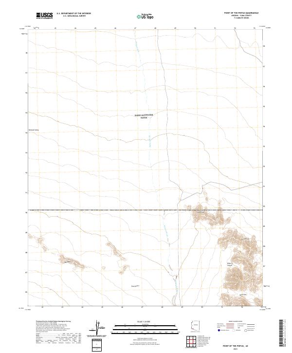
2021 Map of Point of the Pintas
USGS Topo · Published 2021About this map
The Sierra Pinta range dominates this landscape in Yuma County, characterized by a series of dramatic mountain peaks and canyons that overlook the arid Tule Desert. This 2021 topographic record reveals a terrain defined by its drainage patterns and verticality, where the ephemeral Mohawk Wash threads northward through the Mohawk Valley. The landforms are distinctively named, including the prominent Point of the Pintas and the isolated Devil Hills to the west. This southwestern Arizona corridor shows minimal human infrastructure, emphasizing the natural topography of high desert passes like Bean Pass and deep cuts like What Fo Canyon. For those studying the Yuma desert, this map identifies the precise township and range boundaries across this sparsely settled corner of the state.
Find a feature on this map
12 named features on this map. Tap any name to fly to it.
Don’t see what you’re looking for? This feature index may not catch every label — zoom into the map to look around manually.
Map Details
Editions of this 2021 Point of the Pintas Map
This is the sole edition of this map. No revisions or reprints were ever made.
Other maps of this area

1926 · Mohawk
USGS Topo · 1:62,500

1927 · Kim
USGS Topo · 1:62,500

1928 · Mohawk
USGS Topo · 1:62,500

1931 · Kim
USGS Topo · 1:62,500

1953 · Ajo
USGS Topo · 1:250,000

1957 · Ajo
USGS Topo · 1:250,000

1958 · Ajo
USGS Topo · 1:250,000

1962 · Ajo
USGS Topo · 1:250,000

1963 · Ajo
USGS Topo · 1:250,000

1965 · Cabeza Prieta Peak
USGS Topo · 1:62,500