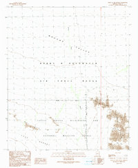
1990 Map of Point of the Pintas
USGS Topo · Published 1991About this map
Cabeza Prieta Wilderness and National Wildlife Refuge dominates the southern half of this landscape, where the Devil Hills and Tule Desert meet the rising slopes of the Sierra Pinta. This remote stretch of Yuma County is defined by its transition from the wide, drainage-carved Mohawk Valley to the rocky outcrops of Point of the Pintas. In the north, the Barry M Goldwater Air Force Range marks a significant military footprint on the land, while a solitary Mine Shaft and the 4WD trails snaking through What Fo Canyon and Bean Pass suggest a history of prospecting and desert navigation. The map illustrates the complex intersection of military training grounds and protected wildlife corridors along the Mohawk Wash, highlighting a region where human activity is strictly bounded by environmental and national security designations.
Find a feature on this map
15 named features on this map. Tap any name to fly to it.
Don’t see what you’re looking for? This feature index may not catch every label — zoom into the map to look around manually.
Map Details
Editions of this 1990 Point of the Pintas Map
This is the sole edition of this map. No revisions or reprints were ever made.
Other maps of this area

1926 · Mohawk
USGS Topo · 1:62,500

1927 · Kim
USGS Topo · 1:62,500

1928 · Mohawk
USGS Topo · 1:62,500

1931 · Kim
USGS Topo · 1:62,500

1953 · Ajo
USGS Topo · 1:250,000

1957 · Ajo
USGS Topo · 1:250,000

1958 · Ajo
USGS Topo · 1:250,000

1962 · Ajo
USGS Topo · 1:250,000

1963 · Ajo
USGS Topo · 1:250,000

1965 · Cabeza Prieta Peak
USGS Topo · 1:62,500