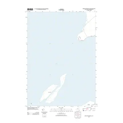
2013 Map of Point Peninsula
USGS Topo · Published 2013About this map
Lake Ontario dominates this coastal landscape, surrounding the distinct landmasses of Stony Island and its smaller neighbor, Calf Island. These offshore features are notable for their isolation within the eastern waters of the Great Lakes, showing a landscape defined by natural shorelines and minimal development. On the mainland, the map reveals a small network of roads that hint at the local history and utility of the peninsula. Residential and local access is provided by routes such as Ledgerock Ln and Buchanans Path, while the presence of the Stony Point Rifle Range and N Schoolhouse Rd suggests a mix of military or community infrastructure and former rural school district locations. The area near Hovey Rd and S Shore Rd reflects the specialized land use typical of Jefferson County's waterfront segments during the early 21st century.
Find a feature on this map
10 named features on this map. Tap any name to fly to it.
Don’t see what you’re looking for? This feature index may not catch every label — zoom into the map to look around manually.
Map Details
Editions of this 2013 Point Peninsula Map
This is the sole edition of this map. No revisions or reprints were ever made.
Other maps of this area

1893 · Sackets Harbor
USGS Topo · 1:62,500

1895 · Sacketts Harbor
USGS Topo · 1:62,500

1895 · Stony Island
USGS Topo · 1:62,500

1895 · Cape Vincent
USGS Topo · 1:62,500

1900 · Clayton
USGS Topo · 1:62,500

1903 · Clayton
USGS Topo · 1:62,500

1942 · Stony Point
USGS Topo · 1:31,680

1942 · Henderson Bay
USGS Topo · 1:31,680

1942 · Chaumont
USGS Topo · 1:31,680

1942 · Galloo Island
USGS Topo · 1:31,680