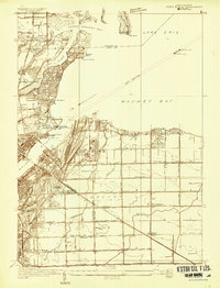
1934 Map of Point Place
USGS Topo · Published 1934About this map
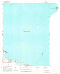
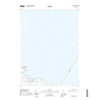
Maumee Bay and the mouth of the Ottawa River anchor this 1934 survey of the shoreline northeast of Toledo. The landscape shows a distinct transition from the residential grids of Point Place and Harbor View to the expansive wetlands and agricultural drainage networks of Oregon township. Industrial and maritime infrastructure is prominent, including the Homestead Yards and the Wheeling and Lake Erie railroad line, alongside navigation aids like the East Crib Light and West Crib Light positioned in Lake Erie.
Find a feature on this map
78 named features on this map. Tap any name to fly to it.
Don’t see what you’re looking for? This feature index may not catch every label — zoom into the map to look around manually.
Map Details
Editions of this 1934 Point Place Map
This is the sole edition of this map. No revisions or reprints were ever made.
Historical Maps of Toledo Through Time
10 maps found
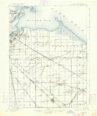
1900 Maumee Bay
Lucas County, OH
1934 Point Place
Lucas County, OH
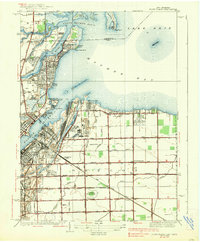
1938 Point Place
Lucas County, OH
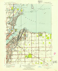
1952 Point Place
Lucas County, OH
1964 Metzger Marsh
Lucas County, OH
2010 Metzger Marsh
Lucas County, OH
2013 Metzger Marsh
Lucas County, OH
2016 Metzger Marsh
Lucas County, OH
2019 Metzger Marsh
Lucas County, OH
2023 Metzger Marsh
Lucas County, OH