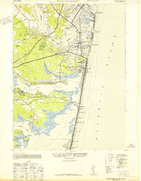
1947 Map of Point Pleasant
USGS Topo · Published 1947About this map
Manasquan Inlet and the Atlantic Ocean shoreline define this mid-century survey of the Jersey Shore, capturing a landscape of established coastal resorts and inland river settlements. The maritime character of the region is evident in landmarks like the Life Saving Station Manasquan Beach and the Mantoloking Boat Works, while the transportation network is anchored by the New York and Long Branch RR and the Pennsylvania RR.
Find a feature on this map
87 named features on this map. Tap any name to fly to it.
Don’t see what you’re looking for? This feature index may not catch every label — zoom into the map to look around manually.
Map Details
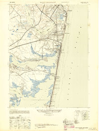
Editions of this 1947 Point Pleasant Map
2 editions found
Other maps of this area

1888 · Barnegat
USGS Topo · 1:62,500

1888 · Asbury Park
USGS Topo · 1:62,500

1893 · Asbury Park
USGS Topo · 1:62,500

1893 · Barnegat
USGS Topo · 1:62,500

1898 · Barnegat
USGS Topo · 1:62,500

1901 · Asbury Park
USGS Topo · 1:62,500

1902 · Navesink
USGS Topo · 1:125,000

1919 · Barnegat
USGS Topo · 1:62,500

1919 · Asbury Park
USGS Topo · 1:62,500

1941 · Toms River
USGS Topo · 1:62,500