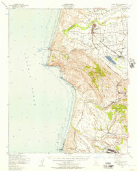
1947 Map of Point Sal
USGS Topo · Published 1957About this map
Guadalupe and the surrounding Santa Maria Valley are depicted here during the mid-century, showcasing a landscape defined by intensive agriculture, rail transport, and military expansion. The Southern Pacific line acts as the primary corridor through this coastal region, connecting the settlement of Betteravia—noted for its proximity to an industrial Oil Field and Stockyards—with the southern reaches of the Camp Cooke Military Reservation.
Find a feature on this map
35 named features on this map. Tap any name to fly to it.
Don’t see what you’re looking for? This feature index may not catch every label — zoom into the map to look around manually.
Map Details
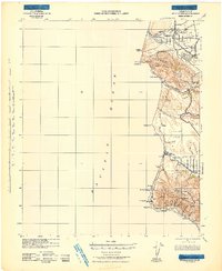
Editions of this 1947 Point Sal Map
2 editions found

Other maps of this area

1897 · Port Harford
USGS Topo · 1:62,500

1897 · Arroyo Grande
USGS Topo · 1:62,500

1900 · San Luis
USGS Topo · 1:125,000

1905 · Guadalupe
USGS Topo · 1:125,000

1905 · Lompoc
USGS Topo · 1:125,000

1922 · Nipomo
USGS Topo · 1:62,500

1941 · Port San Luis
USGS Topo · 1:62,500

1942 · Point Arguello
USGS Topo · 1:62,500
1942 · Guadalupe
USGS Topo · 1:125,000

1942 · Lompoc
USGS Topo · 1:125,000