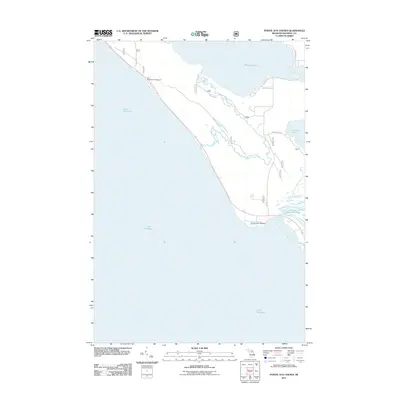
2011 Map of Pointe aux Chenes
USGS Topo · Published 2011About this map
Pointe aux Chenes sits along the northern edge of Lake Michigan in this 2011 survey, marking a coastline defined by intricate waterways and significant wetlands. The landscape is dominated by the Pointe aux Chenes Marshes, where the Pointe aux Chenes River meets the lake's namesake bay. To the north, the larger expanse of Brevort Lake is connected to the shoreline by the winding Brevort River, while Christensen Bay and Round Lake provide further geographic detail to the Upper Peninsula's hydrology. Recreation and access are established via the Lake Michigan Campground and a network of local thoroughfares including Round Lake Rd and Knowles Rd. The survey illustrates the persistence of these natural features and small settlements in Mackinac County, documenting the area's shoreline before more recent environmental shifts.
Find a feature on this map
14 named features on this map. Tap any name to fly to it.
Don’t see what you’re looking for? This feature index may not catch every label — zoom into the map to look around manually.
Map Details
Editions of this 2011 Pointe aux Chenes Map
This is the sole edition of this map. No revisions or reprints were ever made.
Other maps of this area

1931 · Epoufette SE
USGS Topo · 1:31,680

1931 · Moran NE
USGS Topo · 1:31,680

1931 · Ozark SE
USGS Topo · 1:31,680

1948 · Moran NE
USGS Topo · 1:31,680

1948 · Moran NW
USGS Topo · 1:31,680

1954 · Sault Sainte Marie
USGS Topo · 1:250,000

1955 · Cheboygan
USGS Topo · 1:250,000

1956 · Sault Sainte Marie
USGS Topo · 1:250,000

1957 · Sault Sainte Marie
USGS Topo · 1:250,000

1958 · Cheboygan
USGS Topo · 1:250,000