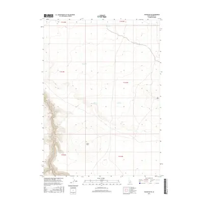
2017 Map of Poison Butte
USGS Topo · Published 2017About this map
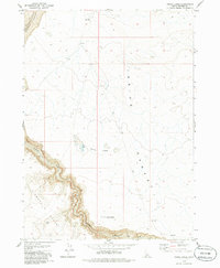
Poison Butte and Mid Butte define the topography of this high-desert Owyhee County landscape, where the seasonal management of water is central to the land's utility. The presence of several catchments, such as Post Office Reservoir and Lake Pit Reservoir, reflects a region shaped by ranching and grazing requirements in an arid environment. The Jarbidge River cuts through the southwestern corner, joined by the drainage of Dorsey Cr, providing a critical water source for the surrounding plateaus. This 2017 study illustrates the enduring Public Land Survey System grid across the townships of T13S through T15S, showing how modern land management remains tethered to nineteenth-century section lines. Isolated water features like Flat Draw Reservoir and Poison Cr Reservoir highlight the scattered, essential infrastructure required to sustain activity in these remote Idaho reaches.
Find a feature on this map
14 named features on this map. Tap any name to fly to it.
Don’t see what you’re looking for? This feature index may not catch every label — zoom into the map to look around manually.
Map Details
Editions of this 2017 Poison Butte Map
This is the sole edition of this map. No revisions or reprints were ever made.
Other maps of this area

1955 · Twin Falls
USGS Topo · 1:250,000

1958 · Twin Falls
USGS Topo · 1:250,000

1978 · The Arch
USGS Topo · 1:24,000

1979 · Cowan Reservoir
USGS Topo · 1:24,000
1979 · Dishpan
USGS Topo · 1:24,000

1979 · Clover Butte South
USGS Topo · 1:24,000

1979 · Mosquito Lake Butte
USGS Topo · 1:24,000
1979 · Poison Butte
USGS Topo · 1:24,000
1979 · Murphy Hot Springs
USGS Topo · 1:24,000
1979 · Inside Lakes
USGS Topo · 1:24,000