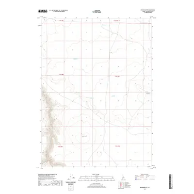
2020 Map of Poison Butte
USGS Topo · Published 2020About this map
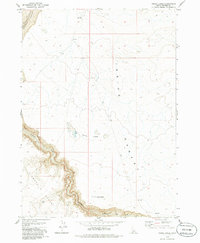
Poison Butte stands as the primary landmark in this corner of Owyhee County, where the high desert landscape is punctuated by a series of essential water catchments. These features, including Post Office Reservoir and Flat Draw Reservoir, illustrate the critical importance of water management in this arid region of Idaho. The map reveals a land divided by township and range lines, showing how modern ranching or land management utilizes small drainages like Poison Cr Reservoir and Lake Pit Reservoir to sustain operations far from the state's major river systems. On the eastern edge, Mid Butte provides a secondary point of orientation for those navigating the high plateaus and creek beds. Seasonal watercourses such as Jacks Creek and Dorsey Cr carve subtle variations into the topography, marking the natural drainage patterns that define this remote high-country environment.
Find a feature on this map
14 named features on this map. Tap any name to fly to it.
Don’t see what you’re looking for? This feature index may not catch every label — zoom into the map to look around manually.
Map Details
Editions of this 2020 Poison Butte Map
This is the sole edition of this map. No revisions or reprints were ever made.
Other maps of this area

1955 · Twin Falls
USGS Topo · 1:250,000

1958 · Twin Falls
USGS Topo · 1:250,000

1978 · The Arch
USGS Topo · 1:24,000

1979 · Cowan Reservoir
USGS Topo · 1:24,000
1979 · Dishpan
USGS Topo · 1:24,000

1979 · Clover Butte South
USGS Topo · 1:24,000

1979 · Mosquito Lake Butte
USGS Topo · 1:24,000
1979 · Poison Butte
USGS Topo · 1:24,000
1979 · Murphy Hot Springs
USGS Topo · 1:24,000
1979 · Inside Lakes
USGS Topo · 1:24,000