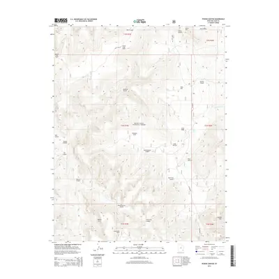
2014 Map of Poison Canyon
USGS Topo · Published 2014About this map
The high plateau of N Elk Ridge dominates this San Juan County landscape, part of the Manti-LaSal National Forest. In this 2014 survey, the intricate drainage patterns of the Colorado River basin are evident through deep incisions like Deadman Canyon, Peavine Canyon, and Drift Trail Canyon. The map reveals a series of named grazing grounds and natural landmarks including Redd Pasture, Poso Pasture, and the notable Queens Arch to the southwest. Human presence is sparse, primarily defined by the winding route of Sweet Alice Rd and established water sources such as Sego Spring and North Notch Spring. Prominent geological features like Steamboat Point and Chimney Park rise above the canyon floor, illustrating the characteristic erosion of the Four Corners region before it descends into the larger systems beyond the quadrangle.
Find a feature on this map
33 named features on this map. Tap any name to fly to it.
Don’t see what you’re looking for? This feature index may not catch every label — zoom into the map to look around manually.
Map Details
Editions of this 2014 Poison Canyon Map
This is the sole edition of this map. No revisions or reprints were ever made.
Other maps of this area

1886 · Abajo
USGS Topo · 1:250,000

1892 · Abajo
USGS Topo · 1:250,000

1893 · Abajo
USGS Topo · 1:250,000

1935 · Elk Ridge
USGS Topo · 1:96,000

1940 · Elk Ridge
USGS Topo · 1:125,000

1954 · Elk Ridge 4 NW
USGS Topo · 1:24,000

1954 · Elk Ridge 1 SW
USGS Topo · 1:24,000

1954 · Elk Ridge 2 SE
USGS Topo · 1:24,000

1954 · Elk Ridge 1 NW
USGS Topo · 1:24,000

1954 · Elk Ridge 3 NE
USGS Topo · 1:24,000