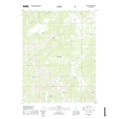
2020 Map of Poison Canyon
USGS Topo · Published 2020About this map
Manti-La Sal National Forest dominates this high-altitude landscape in San Juan County, where sheer cliffs and deep drainages define the geography. The map reveals a network of livestock grazing lands, including Redd Pasture and Poso Pasture, interspersed with dramatic geological features like Steamboat Point and Queens Arch. These named landmarks, alongside the prominent Horse Mountain, reflect a history of cattle ranching and early exploration across the Colorado Plateau.
Find a feature on this map
33 named features on this map. Tap any name to fly to it.
Don’t see what you’re looking for? This feature index may not catch every label — zoom into the map to look around manually.
Map Details
Editions of this 2020 Poison Canyon Map
This is the sole edition of this map. No revisions or reprints were ever made.
Other maps of this area

1886 · Abajo
USGS Topo · 1:250,000

1892 · Abajo
USGS Topo · 1:250,000

1893 · Abajo
USGS Topo · 1:250,000

1935 · Elk Ridge
USGS Topo · 1:96,000

1940 · Elk Ridge
USGS Topo · 1:125,000

1954 · Elk Ridge 4 NW
USGS Topo · 1:24,000

1954 · Elk Ridge 1 SW
USGS Topo · 1:24,000

1954 · Elk Ridge 2 SE
USGS Topo · 1:24,000

1954 · Elk Ridge 1 NW
USGS Topo · 1:24,000

1954 · Elk Ridge 3 NE
USGS Topo · 1:24,000