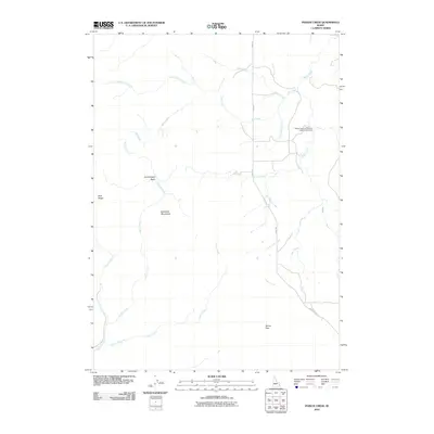
2010 Map of Poison Creek
USGS Topo · Published 2010About this map
The Blackfoot Mountains dominate this high-country landscape in eastern Bingham County, where a network of drainages defines the local topography. This 2010 survey illustrates a region shaped by ranching and public land access, centered on the corridor of Bone Rd as it winds through the hills. Notable landmarks such as Tanner Pass and Blue Ridge provide essential orientation in this terrain of basins and ridges.
Find a feature on this map
18 named features on this map. Tap any name to fly to it.
Don’t see what you’re looking for? This feature index may not catch every label — zoom into the map to look around manually.
Map Details
Editions of this 2010 Poison Creek Map
This is the sole edition of this map. No revisions or reprints were ever made.
Other maps of this area

1917 · Cranes Flat
USGS Topo · 1:62,500

1918 · Paradise Valley
USGS Topo · 1:62,500

1924 · Hell Creek
USGS Topo · 1:62,500

1924 · Ammon
USGS Topo · 1:62,500

1926 · Hell Creek
USGS Topo · 1:62,500

1955 · Driggs
USGS Topo · 1:250,000

1958 · Driggs
USGS Topo · 1:250,000

1962 · Driggs
USGS Topo · 1:250,000
1963 · Bone
USGS Topo · 1:24,000
1981 · Miner Creek
USGS Topo · 1:24,000