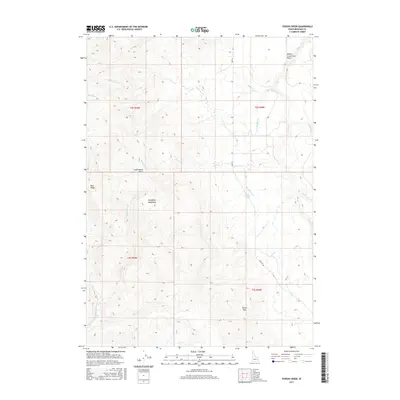
2017 Map of Poison Creek
USGS Topo · Published 2017About this map
The Blackfoot Mountains dominate this high-desert landscape in southeastern Idaho, where the volcanic heritage of the region is clearly visible at the Willow Creek Lava Field in the northeast. The terrain is a network of ridges and drainage basins, notably the Commissary Basin and the prominent Blue Ridge. This area is defined by its complex hydrology, with numerous named streams such as Poison Creek, Levi Hawkley Cr, and Alley Lyons Cr carving through the slopes. Historically, transportation through this rugged portion of Bingham County has been dictated by the natural gaps in the mountains, such as Tanner Pass, and the primary thoroughfare of Bone Rd. The presence of water sources like Butler Spring and named seasonal drainages like Dry Miner indicates the critical importance of water management for the ranching or land use patterns in this high-elevation environment.
Find a feature on this map
25 named features on this map. Tap any name to fly to it.
Don’t see what you’re looking for? This feature index may not catch every label — zoom into the map to look around manually.
Map Details
Editions of this 2017 Poison Creek Map
This is the sole edition of this map. No revisions or reprints were ever made.
Other maps of this area

1917 · Cranes Flat
USGS Topo · 1:62,500

1918 · Paradise Valley
USGS Topo · 1:62,500

1924 · Hell Creek
USGS Topo · 1:62,500

1924 · Ammon
USGS Topo · 1:62,500

1926 · Hell Creek
USGS Topo · 1:62,500

1955 · Driggs
USGS Topo · 1:250,000

1958 · Driggs
USGS Topo · 1:250,000

1962 · Driggs
USGS Topo · 1:250,000
1963 · Bone
USGS Topo · 1:24,000
1981 · Miner Creek
USGS Topo · 1:24,000