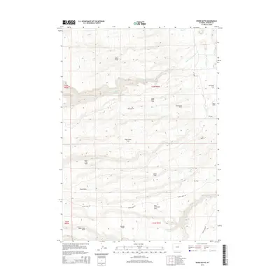
2015 Map of Poker Butte
USGS Topo · Published 2015About this map
The Middle Fork Powder River carves through this portion of Johnson County, defining a landscape of dramatic elevation changes and named drainages. The topography is marked by significant features like Poker Butte and The Mesa, while the southern reaches contain the uniquely named Hole-in-the-Wall Slope. This region is characterized by large open spaces and public lands, including Poker Creek Parks, Ghent Parks, and Eagle Creek Parks. Ranching and land management are evident through the network of access routes like Bar C Rd and Buffalo Creek Rd. Historically significant landmarks, such as Old Man Spring and The Trap, suggest long-standing use of the terrain for livestock and navigation. Smaller watercourses like Sheep Cr and N Poker Cr weave through the draws and slopes, illustrating the complex hydrology of the Wyoming high country.
Find a feature on this map
31 named features on this map. Tap any name to fly to it.
Don’t see what you’re looking for? This feature index may not catch every label — zoom into the map to look around manually.
Map Details
Editions of this 2015 Poker Butte Map
This is the sole edition of this map. No revisions or reprints were ever made.
Other maps of this area

1955 · Arminto
USGS Topo · 1:250,000

1958 · Arminto
USGS Topo · 1:250,000

1961 · Barnum
USGS Topo · 1:62,500

1962 · Arminto
USGS Topo · 1:250,000

1967 · Gordon Creek
USGS Topo · 1:24,000

1967 · Turk Springs
USGS Topo · 1:24,000

1968 · First Water Draw
USGS Topo · 1:24,000

1968 · Willow Creek School
USGS Topo · 1:24,000

1968 · Roughlock Hill
USGS Topo · 1:24,000
1979 · Red Fork Powder River
USGS Topo · 1:24,000