
1961 Map of Barnum
USGS Topo · Published 1962About this map
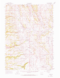
Barnum and its surrounding ranchlands are situated at the dramatic break between the high plateaus and the rugged canyon systems of the Middle Fork Powder River. This landscape is defined by its deep historical ties to the Old West, specifically the infamous Hole-in-the-Wall Slope and Outlaw Cave, which provided natural fortification for late 19th-century fugitives. The mapping reveals a sparse but established network of homesteads and water management, including the Winsor Ditch and Barnum Ditch that supported livestock in this arid environment. Many family names are preserved on the land, from the Elmer Rinker Homestead to the Wolcott Ranch, reflecting the legacy of early Wyoming settlement. The complex terrain of ridges such as Elder Ridge and Poison Weed Ridge dictates the placement of the various jeep trails and the Arminto Road, which serve as the primary conduits through this secluded portion of Johnson County.
Find a feature on this map
72 named features on this map. Tap any name to fly to it.
Don’t see what you’re looking for? This feature index may not catch every label — zoom into the map to look around manually.
Map Details
Editions of this 1961 Barnum Map
2 editions found
Other maps of this area

1955 · Arminto
USGS Topo · 1:250,000

1958 · Arminto
USGS Topo · 1:250,000

1961 · TTT Ranch
USGS Topo · 1:24,000

1961 · Hibbard Draw
USGS Topo · 1:24,000

1961 · Kaycee
USGS Topo · 1:24,000

1962 · Arminto
USGS Topo · 1:250,000

1963 · Mayoworth
USGS Topo · 1:62,500
1967 · Tabletop
USGS Topo · 1:24,000

1967 · Gordon Creek
USGS Topo · 1:24,000

1967 · Turk Springs
USGS Topo · 1:24,000