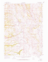
1961 Map of Barnum
USGS Topo · Published 1971About this map
Barnum serves as a central point in this high-plains landscape where the forks of the Powder River converge. The 1961 field check documents a ranching economy defined by family names and irrigation, featuring an extensive network of ditches such as the Barnum Ditch, Beaver Creek Ditch, and White Panther Ditch. The terrain is dominated by significant geological formations, including the red-walled notch of the Hole-in-the-Wall and landmarks like Steamboat Rock and Castle Rock. Isolated residences and legacy sites such as the Elmer Rinker Homestead, Ghent Homestead, and Spangler Cabin are scattered across the slopes and draws, illustrating the distribution of early settlement along the Middle Fork Powder River and its various tributaries. This survey captures the region's transition from early homesteading to established cattle ranching, with the National Forest Boundary marking the higher elevations of Gardner Mountain.
Find a feature on this map
79 named features on this map. Tap any name to fly to it.
Don’t see what you’re looking for? This feature index may not catch every label — zoom into the map to look around manually.
Map Details
Editions of this 1961 Barnum Map
2 editions found
Other maps of this area

1955 · Arminto
USGS Topo · 1:250,000

1958 · Arminto
USGS Topo · 1:250,000

1961 · Barnum
USGS Topo · 1:62,500

1961 · TTT Ranch
USGS Topo · 1:24,000

1961 · Hibbard Draw
USGS Topo · 1:24,000

1961 · Kaycee
USGS Topo · 1:24,000

1962 · Arminto
USGS Topo · 1:250,000

1963 · Mayoworth
USGS Topo · 1:62,500
1967 · Tabletop
USGS Topo · 1:24,000

1967 · Gordon Creek
USGS Topo · 1:24,000