
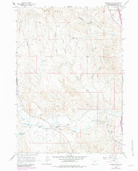
1961 Map of Hibbard Draw
USGS Topo · Published 1965About this map
The North Fork Powder River carves through this high-plains landscape in Johnson County, anchoring a network of remote ranching operations and water engineering. Ranching families have left their mark across the drainage basins of Hibbard Draw and Antelope Draw, with sites such as the Zigweid Ranch, Crutchet Ranch, and Eychaner Ranch located along the river's path. The presence of the Bob Brock Ditch and Jim Blaine Ditch underscores the vital importance of water rights and irrigation in this arid environment.
Find a feature on this map
32 named features on this map. Tap any name to fly to it.
Don’t see what you’re looking for? This feature index may not catch every label — zoom into the map to look around manually.
Map Details
Editions of this 1961 Hibbard Draw Map
2 editions found
Other maps of this area

1955 · Arminto
USGS Topo · 1:250,000

1958 · Arminto
USGS Topo · 1:250,000

1961 · Barnum
USGS Topo · 1:62,500

1961 · Kaycee NE
USGS Topo · 1:24,000

1961 · Dry Creek Reservoir
USGS Topo · 1:24,000

1961 · Antelope Draw
USGS Topo · 1:24,000

1961 · Schlict Draw
USGS Topo · 1:24,000

1961 · Kaycee
USGS Topo · 1:24,000

1962 · Arminto
USGS Topo · 1:250,000

1963 · Mayoworth
USGS Topo · 1:62,500