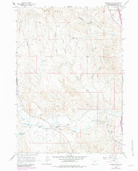
1961 Map of Hibbard Draw
USGS Topo · Published 1982About this map
The North Fork Powder River cuts through this Johnson County landscape, anchoring a network of historic homesteads and early industrial activity. The river bottom is a corridor of ranching life, where the Crutchet Ranch, Zigweid Ranch, and Eyehaner Ranch are positioned near essential water management features like the Blaine Ditch and Broughton Ditch. These irrigation works reflect the effort required to support agriculture in this arid region of the High Plains.
Find a feature on this map
33 named features on this map. Tap any name to fly to it.
Don’t see what you’re looking for? This feature index may not catch every label — zoom into the map to look around manually.
Map Details
Editions of this 1961 Hibbard Draw Map
2 editions found
Other maps of this area

1955 · Arminto
USGS Topo · 1:250,000

1958 · Arminto
USGS Topo · 1:250,000

1961 · Barnum
USGS Topo · 1:62,500

1961 · Kaycee NE
USGS Topo · 1:24,000

1961 · Dry Creek Reservoir
USGS Topo · 1:24,000

1961 · Antelope Draw
USGS Topo · 1:24,000

1961 · Schlict Draw
USGS Topo · 1:24,000

1961 · Hibbard Draw
USGS Topo · 1:24,000

1961 · Kaycee
USGS Topo · 1:24,000

1962 · Arminto
USGS Topo · 1:250,000