
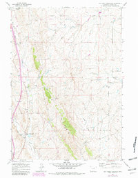
1961 Map of Dry Creek Reservoir
USGS Topo · Published 1964About this map
The Pine Ridge escarpment dominates this Wyoming landscape, its forested slopes standing in sharp contrast to the surrounding draws and grazing lands. This early 1960s survey documents a working ranching economy in Johnson County, defined by family-run operations such as the Meike Brothers Ranch, Goyheneix Ranch, and Williams Ranch. The topography is heavily shaped by seasonal drainage patterns, with numerous ephemeral waterways like Bybee Draw and Denny Draw feeding into larger systems like Dry Creek and the North Fork Powder River.
Find a feature on this map
27 named features on this map. Tap any name to fly to it.
Don’t see what you’re looking for? This feature index may not catch every label — zoom into the map to look around manually.
Map Details
Editions of this 1961 Dry Creek Reservoir Map
2 editions found
Other maps of this area

1955 · Arminto
USGS Topo · 1:250,000

1958 · Arminto
USGS Topo · 1:250,000

1961 · Kaycee NE
USGS Topo · 1:24,000

1961 · Fourmile Reservoir
USGS Topo · 1:24,000

1961 · Figure 8 Reservoir
USGS Topo · 1:24,000

1961 · Antelope Draw
USGS Topo · 1:24,000

1961 · Schlict Draw
USGS Topo · 1:24,000

1961 · Elaine Draw
USGS Topo · 1:24,000

1961 · Hibbard Draw
USGS Topo · 1:24,000

1961 · Kaycee
USGS Topo · 1:24,000