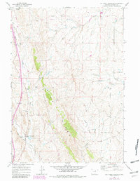
1961 Map of Dry Creek Reservoir
USGS Topo · Published 1982About this map
Pine Ridge dominates the central topography of this Wyoming ranching landscape, acting as a natural divide between the various draws and creek beds that define the area. The map illustrates a dispersed pastoral economy in the early 1960s, centered around sheep camps and family-operated ranching headquarters such as Taylor Brothers Sheep Camp and the Melke Brothers Ranch. These operations are connected by a network of unimproved roads and the prominent Stock Trail running through the northwest corner. To the south, the terrain descends toward the North Fork Powder River, while the presence of the Sippie Mine and a modern pipeline reflects the beginning of industrial expansion into the traditional grazing lands. Water management is critical here, evidenced by the Dry Creek Reservoir and smaller reservoirs like Stock Trail Res No 1 scattered across the sagebrush-covered hills.
Find a feature on this map
25 named features on this map. Tap any name to fly to it.
Don’t see what you’re looking for? This feature index may not catch every label — zoom into the map to look around manually.
Map Details
Editions of this 1961 Dry Creek Reservoir Map
2 editions found
Other maps of this area

1955 · Arminto
USGS Topo · 1:250,000

1958 · Arminto
USGS Topo · 1:250,000

1961 · Kaycee NE
USGS Topo · 1:24,000

1961 · Fourmile Reservoir
USGS Topo · 1:24,000

1961 · Figure 8 Reservoir
USGS Topo · 1:24,000

1961 · Dry Creek Reservoir
USGS Topo · 1:24,000

1961 · Antelope Draw
USGS Topo · 1:24,000

1961 · Schlict Draw
USGS Topo · 1:24,000

1961 · Elaine Draw
USGS Topo · 1:24,000

1961 · Hibbard Draw
USGS Topo · 1:24,000