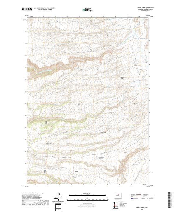
2021 Map of Poker Butte
USGS Topo · Published 2021About this map
The Middle Fork Powder River carves through this high-altitude landscape of central Wyoming, defined by the sharp elevations of North River Slope and South River Slope. The area is steeped in regional lore, most notably represented by the Outlaw Cave Trl and the notorious Hole-in-the-Wall Slope, long associated with the hideouts of the Old West. This modern survey illustrates the rugged drainage patterns of Buffalo Cr and N Poker Cr, where the terrain transitions into open grazing lands and meadows known locally as Poker Creek Parks and Ghent Parks. The map reveals a sparsely populated ranching environment where movement is dictated by the few improved routes like Buffalo Creek Rd and Bar C Rd, connecting isolated landmarks such as The Trap and The Mesa.
Find a feature on this map
29 named features on this map. Tap any name to fly to it.
Don’t see what you’re looking for? This feature index may not catch every label — zoom into the map to look around manually.
Map Details
Editions of this 2021 Poker Butte Map
This is the sole edition of this map. No revisions or reprints were ever made.
Other maps of this area

1955 · Arminto
USGS Topo · 1:250,000

1958 · Arminto
USGS Topo · 1:250,000

1961 · Barnum
USGS Topo · 1:62,500

1962 · Arminto
USGS Topo · 1:250,000

1967 · Gordon Creek
USGS Topo · 1:24,000

1967 · Turk Springs
USGS Topo · 1:24,000

1968 · First Water Draw
USGS Topo · 1:24,000

1968 · Willow Creek School
USGS Topo · 1:24,000

1968 · Roughlock Hill
USGS Topo · 1:24,000
1979 · Red Fork Powder River
USGS Topo · 1:24,000