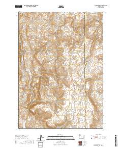
2020 Map of Pole Creek Top
USGS Topo · Published 2020About this map
Owyhee Mountains terrain dominates this borderland survey, where the high desert of Malheur County meets Idaho. The landscape is defined by its drainages and catchment systems, notably Cunningham Reservoir, Hot Rock Reservoir, and Rocky Bottom Reservoir, which reflect the essential role of water management in this arid grazing country. Distinctive geological markers like Negro Rock and the high summit of Pole Creek Top provide navigation points across the basins. Ranching history is embedded in place names such as Spanish Charlie Basin and Strode Basin, while seasonal waterways like Succor Cr and Trimbley Cr carve through the draws. The map also records the primitive road network, including Succor Creek Rd and Antelope Spring Rd, which follow the natural contours of the hills.
Find a feature on this map
28 named features on this map. Tap any name to fly to it.
Don’t see what you’re looking for? This feature index may not catch every label — zoom into the map to look around manually.
Map Details
Editions of this 2020 Pole Creek Top Map
This is the sole edition of this map. No revisions or reprints were ever made.
Other maps of this area

1892 · Silver City
USGS Topo · 1:125,000

1894 · Silver City
USGS Topo · 1:125,000

1898 · Nampa
USGS Topo · 1:125,000

1898 · Silver City
USGS Topo · 1:125,000

1906 · Mitchell Butte
USGS Topo · 1:125,000

1955 · Boise
USGS Topo · 1:250,000

1957 · Sands Basin
USGS Topo · 1:62,500

1958 · Boise
USGS Topo · 1:250,000

1958 · Homedale
USGS Topo · 1:24,000

1962 · Boise
USGS Topo · 1:250,000