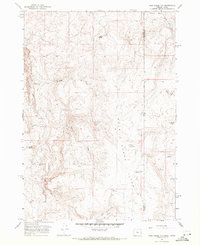
1967 Map of Pole Creek Top
USGS Topo · Published 1971About this map
Spanish Charlie Basin and Strode Basin define the high desert topography along the state border in the late 1960s. The landscape is characterized by a series of high-elevation water sources including Antelope Spring and several man-made impoundments such as Mitzi Reservoir, Rocky Bottom Reservoir, and Cunningham Res. The region's drainage pattern is dominated by Succor Creek and Pole Creek, with numerous smaller tributaries like Trimble Creek and Fallon Creek cutting through the terrain. Evidence of early range management and movement is found in the network of Jeep Trails and the naming of landmarks like Negro Rock and Rocky Ford. This survey details the intersection of Malheur and Owyhee Counties where the high plateau of eastern Oregon meets western Idaho.
Find a feature on this map
20 named features on this map. Tap any name to fly to it.
Don’t see what you’re looking for? This feature index may not catch every label — zoom into the map to look around manually.
Map Details
Editions of this 1967 Pole Creek Top Map
This is the sole edition of this map. No revisions or reprints were ever made.
Other maps of this area

1892 · Silver City
USGS Topo · 1:125,000

1894 · Silver City
USGS Topo · 1:125,000

1898 · Nampa
USGS Topo · 1:125,000

1898 · Silver City
USGS Topo · 1:125,000

1906 · Mitchell Butte
USGS Topo · 1:125,000

1955 · Boise
USGS Topo · 1:250,000

1957 · Sands Basin
USGS Topo · 1:62,500

1958 · Boise
USGS Topo · 1:250,000

1958 · Homedale
USGS Topo · 1:24,000

1962 · Boise
USGS Topo · 1:250,000