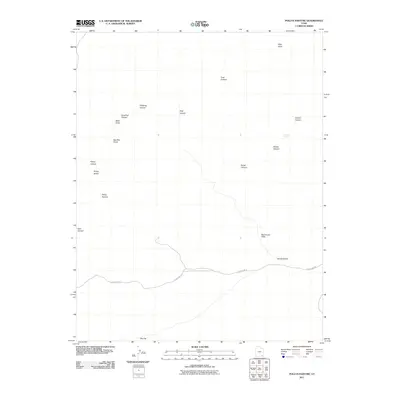
2011 Map of Pollys Pasture
USGS Topo · Published 2011About this map
Red House Cliffs and the surrounding drainage systems dominate this corner of San Juan County, Utah, as surveyed in 2011. The landscape is characterized by a high frequency of canyon networks, including Bullet Canyon, Sheiks Canyon, and Dripping Canyon. These natural features, along with Pollys Pasture and Pollys Island, reflect a geography where vertical relief dictates movement and utility. Modern infrastructure is limited to Slick Horn Rd, which traverses the southern portion of the sheet near Hardscrabble. Cultural markers such as Big Man Panel hint at the area's archaeological importance, while hydrologic features like The Thumb Pour Off suggest the intermittent water flow common to this arid environment. The map provides a precise account of local landmarks such as Step Point and Hat Flat, serving as a detailed guide to the region's topography.
Find a feature on this map
19 named features on this map. Tap any name to fly to it.
Don’t see what you’re looking for? This feature index may not catch every label — zoom into the map to look around manually.
Map Details
Editions of this 2011 Pollys Pasture Map
This is the sole edition of this map. No revisions or reprints were ever made.
Other maps of this area

1886 · Henry Mountains
USGS Topo · 1:250,000

1886 · Abajo
USGS Topo · 1:250,000

1892 · Abajo
USGS Topo · 1:250,000

1892 · Henry Mountains
USGS Topo · 1:250,000

1893 · Abajo
USGS Topo · 1:250,000

1935 · Elk Ridge
USGS Topo · 1:96,000

1940 · Elk Ridge
USGS Topo · 1:125,000

1952 · Natural Bridges
USGS Topo · 1:62,500

1954 · White Canyon 4 SE
USGS Topo · 1:24,000

1954 · White Canyon 4 SW
USGS Topo · 1:24,000