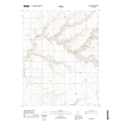
2020 Map of Pollys Pasture
USGS Topo · Published 2020About this map
Big Man Panel stands as a significant cultural landmark within this high-desert landscape of San Juan County, Utah. The terrain is defined by deep incisions like Grand Gulch and Slickhorn Canyon, which carve through the prominent elevations of Cedar Mesa and Polly Mesa. Named springs, including Green Mask Spring, Jailhouse Spring, and Bullet Canyon Spring, indicate the vital water sources that have supported life in this arid environment. The naming conventions throughout the area, such as Pollys Pasture, Steer Gulch, and Cow Trail Canyon, reflect a legacy of livestock management and early ranching efforts amidst the formidable Red House Cliffs. Modern access is limited to a few primitive routes like Slick Horn Rd and Point Lookout Rd, preserving the remote character of features like Pollys Island and Hardscrabble.
Find a feature on this map
33 named features on this map. Tap any name to fly to it.
Don’t see what you’re looking for? This feature index may not catch every label — zoom into the map to look around manually.
Map Details
Editions of this 2020 Pollys Pasture Map
This is the sole edition of this map. No revisions or reprints were ever made.
Other maps of this area

1886 · Henry Mountains
USGS Topo · 1:250,000

1886 · Abajo
USGS Topo · 1:250,000

1892 · Abajo
USGS Topo · 1:250,000

1892 · Henry Mountains
USGS Topo · 1:250,000

1893 · Abajo
USGS Topo · 1:250,000

1935 · Elk Ridge
USGS Topo · 1:96,000

1940 · Elk Ridge
USGS Topo · 1:125,000

1952 · Natural Bridges
USGS Topo · 1:62,500

1954 · White Canyon 4 SE
USGS Topo · 1:24,000

1954 · White Canyon 4 SW
USGS Topo · 1:24,000