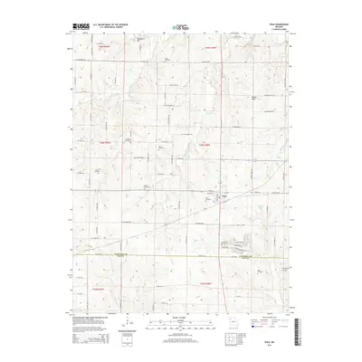
2014 Map of Polo
USGS Topo · Published 2014About this map
Polo serves as the central hub of this agricultural landscape along the boundary of Caldwell and Ray Counties. The town's grid is flanked by a significant concentration of rural burial grounds, including the Wiley Cemetery and Zimmerman Cemetery, which offer valuable data for family historians tracking the area's early settlers. The topography is defined by the elevation of Yankee Ridge and Needmore Hill, overlooking a network of small waterways like Brush Cr and Log Cr. Outside of the primary settlement, the map reveals a high density of family-named cemeteries such as Dunkard Cemetery and Baker Cemetery, reflecting the decentralized nature of nineteenth-century Missouri farm life and the persistence of these homestead landmarks into the modern era.
Find a feature on this map
87 named features on this map. Tap any name to fly to it.
Don’t see what you’re looking for? This feature index may not catch every label — zoom into the map to look around manually.
Map Details
Editions of this 2014 Polo Map
This is the sole edition of this map. No revisions or reprints were ever made.
Other maps of this area

1889 · Lexington
USGS Topo · 1:125,000

1894 · Independence
USGS Topo · 1:125,000

1924 · Polo
USGS Topo · 1:62,500

1924 · Braymer
USGS Topo · 1:62,500

1950 · Kansas City
USGS Topo · 1:250,000

1953 · Moberly
USGS Topo · 1:250,000

1954 · Kansas City
USGS Topo · 1:250,000

1954 · Moberly
USGS Topo · 1:250,000

1956 · Kansas City
USGS Topo · 1:250,000

1957 · Moberly
USGS Topo · 1:250,000