2021 Map of Polo
USGS Topo · Published 2021About this map
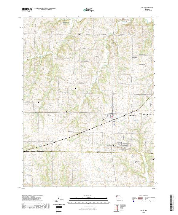
Polo serves as the central hub of this agricultural landscape along the border of Caldwell and Ray counties. The terrain is defined by a dense network of country roads and several prominent ridges, most notably Yankee Ridge to the northeast and Needmore Hill in the north. For genealogists, this 2021 survey is exceptionally detailed, documenting numerous family and community burial grounds scattered across the countryside, including Dunkard Cem, Mayes Cem, and Dixon Cem. Waterways like Log Cr and Cockerel Cr cut through the rolling topography, while Hicks Lake provides a localized landmark just east of the main settlement. The map illustrates a modern rural layout where longstanding family landmarks, such as Baker Cem and McVeigh Cem, persist alongside contemporary infrastructure like State Hwy T and the intricate grid of county roads.
Find a feature on this map
91 named features on this map. Tap any name to fly to it.
Don’t see what you’re looking for? This feature index may not catch every label — zoom into the map to look around manually.
Map Details
Editions of this 2021 Polo Map
This is the sole edition of this map. No revisions or reprints were ever made.