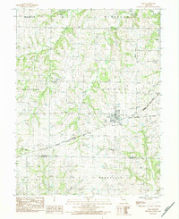
1984 Map of Polo
USGS Topo · Published 1984About this map
Polo serves as a central hub in this agricultural landscape spanning the Caldwell and Ray County line during the early 1980s. The town's layout is defined by the intersection of major rail lines, including the Chicago Milwaukee St Paul and Pacific and the Chicago and North Western. This rail network, alongside an old RR grade to the west, underscores the historical importance of transit and trade for these rural Missouri townships.
Find a feature on this map
34 named features on this map. Tap any name to fly to it.
Don’t see what you’re looking for? This feature index may not catch every label — zoom into the map to look around manually.
Map Details
Editions of this 1984 Polo Map
This is the sole edition of this map. No revisions or reprints were ever made.
Other maps of this area

1889 · Lexington
USGS Topo · 1:125,000

1894 · Independence
USGS Topo · 1:125,000

1924 · Polo
USGS Topo · 1:62,500

1924 · Braymer
USGS Topo · 1:62,500

1950 · Kansas City
USGS Topo · 1:250,000

1953 · Moberly
USGS Topo · 1:250,000

1954 · Kansas City
USGS Topo · 1:250,000

1954 · Moberly
USGS Topo · 1:250,000

1956 · Kansas City
USGS Topo · 1:250,000

1957 · Moberly
USGS Topo · 1:250,000