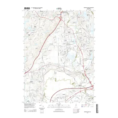
2014 Map of Pompton Plains
USGS Topo · Published 2014About this map
Pompton River drainage patterns and suburban development define this north Jersey landscape where the borders of Morris, Passaic, and Essex counties converge. This 2014 edition illustrates the dense residential layout of Pompton Plains, Wayne, and Pequannock, set against the rising elevations of Waughaw Mtn and Pyramid Mtn. The map preserves the traces of early infrastructure, notably the Morris Canal winding through Towaco, and the historic thoroughfare of the Paterson-Hamburg Tpke. Genealogists will find numerous burial grounds documented, from the Mt Rest Cem and Brown Cem in the north to the Pine Brook Cem and Clinton Cem further south. Modern aviation is represented by the Essex County Airport, while the region's managed water resources are prominent through the Point View Reservoir and Taylortown Reservoir.
Find a feature on this map
84 named features on this map. Tap any name to fly to it.
Don’t see what you’re looking for? This feature index may not catch every label — zoom into the map to look around manually.
Map Details
Editions of this 2014 Pompton Plains Map
This is the sole edition of this map. No revisions or reprints were ever made.
Other maps of this area

1888 · Morristown
USGS Topo · 1:62,500

1888 · Paterson
USGS Topo · 1:62,500

1891 · Greenwood Lake
USGS Topo · 1:62,500

1891 · Ramapo
USGS Topo · 1:62,500

1892 · Paterson
USGS Topo · 1:62,500

1893 · Greenwood Lake
USGS Topo · 1:62,500

1893 · Ramapo
USGS Topo · 1:62,500

1894 · Morristown
USGS Topo · 1:62,500

1898 · Morristown
USGS Topo · 1:62,500

1898 · Paterson
USGS Topo · 1:62,500