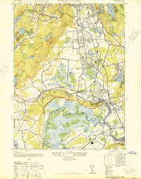
1947 Map of Pompton Plains
USGS Topo · Published 1947About this map
The Pompton Plains and Pequannock area transitions from established valley settlements to the marshy lowlands of the Great Piece Meadows and Bog and Vly Meadows. In the late 1940s, this region was a critical nexus for early aviation, featuring three distinct landing fields: North Jersey Airport, Murchio Airport, and Lincoln Park Airport. These airfields sit alongside a complex transportation network that includes the Erie RR and the New York Susquehanna and Western RR.
Find a feature on this map
56 named features on this map. Tap any name to fly to it.
Don’t see what you’re looking for? This feature index may not catch every label — zoom into the map to look around manually.
Map Details
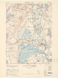
Editions of this 1947 Pompton Plains Map
2 editions found
Other maps of this area

1888 · Morristown
USGS Topo · 1:62,500

1888 · Paterson
USGS Topo · 1:62,500

1891 · Greenwood Lake
USGS Topo · 1:62,500

1891 · Ramapo
USGS Topo · 1:62,500

1892 · Paterson
USGS Topo · 1:62,500

1893 · Greenwood Lake
USGS Topo · 1:62,500

1893 · Ramapo
USGS Topo · 1:62,500

1894 · Morristown
USGS Topo · 1:62,500

1898 · Morristown
USGS Topo · 1:62,500

1898 · Paterson
USGS Topo · 1:62,500