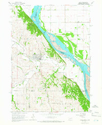
1964 Map of Ponca
USGS Topo · Published 1966About this map
Missouri River bluffs and the wooded breaks of Ponca State Park dominate this 1964 survey at the border of Nebraska and South Dakota. The city of Ponca serves as the focal point, positioned where the rugged topography of the bluffs meets the valley of Aowa Creek. This map captures a landscape defined by sharp elevation changes, from the high vantage point of Lookout Hill to the flat expanse of Civil Bend across the river. Rural education and local infrastructure are well-documented through the locations of the Allard Sch, Pleasant Grove Sch, and Wellenstein Sch. The presence of an Aboveground Pipeline crossing the river and a Gaging Station on Aowa Creek reflects the mid-century management of water and energy resources along this stretch of the Missouri, while the Ponca Cem provides a primary point of interest for those researching local family history.
Find a feature on this map
26 named features on this map. Tap any name to fly to it.
Don’t see what you’re looking for? This feature index may not catch every label — zoom into the map to look around manually.
Map Details
Editions of this 1964 Ponca Map
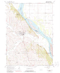
2 editions found
Other maps of this area

1898 · Elk Point
USGS Topo · 1:125,000

1901 · Elk Point
USGS Topo · 1:125,000

1907 · Elk Point
USGS Topo · 1:125,000

1955 · Sioux City
USGS Topo · 1:250,000

1958 · Sioux City
USGS Topo · 1:250,000

1959 · Sioux City
USGS Topo · 1:250,000

1963 · Elk Point
USGS Topo · 1:24,000

1963 · Elk Point NE
USGS Topo · 1:24,000

1963 · Jefferson
USGS Topo · 1:24,000

1964 · Burbank
USGS Topo · 1:24,000
Featured Places
- Ponca, NE
- St. Johns Precinct, NE
- Ottercreek Township, NE
- Civil Bend Township, SD
- Hoffmans Trailer Court, SD