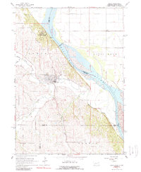
1964 Map of Ponca
USGS Topo · Published 1989About this map
Ponca City serves as the focal point of this northern Nebraska landscape, situated near a dramatic bend in the Missouri River where the waterway forms the boundary between Nebraska and South Dakota. The topography transitions from the river's floodplains at Civil Bend to the deeply dissected bluffs and ridges to the west. This rugged terrain is prominently featured within Ponca State Park, which includes landmarks like Lookout Hill overlooking the river valley. The map reveals a mid-century rural infrastructure defined by several country schools, including Wellenstein Sch and Pleasant Grove Sch, reflecting the distributed nature of the upland farming communities. Water management and drainage are central to the area's geography, with Aowa Creek and South Aowa Creek cutting through the hills toward the Missouri, supported by a Gaging Station used for monitoring these volatile prairie waterways.
Find a feature on this map
23 named features on this map. Tap any name to fly to it.
Don’t see what you’re looking for? This feature index may not catch every label — zoom into the map to look around manually.
Map Details
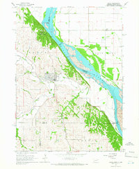
Editions of this 1964 Ponca Map
2 editions found
Other maps of this area

1898 · Elk Point
USGS Topo · 1:125,000

1901 · Elk Point
USGS Topo · 1:125,000

1907 · Elk Point
USGS Topo · 1:125,000

1955 · Sioux City
USGS Topo · 1:250,000

1958 · Sioux City
USGS Topo · 1:250,000

1959 · Sioux City
USGS Topo · 1:250,000

1963 · Elk Point
USGS Topo · 1:24,000

1963 · Elk Point NE
USGS Topo · 1:24,000

1963 · Jefferson
USGS Topo · 1:24,000

1964 · Burbank
USGS Topo · 1:24,000
Featured Places
- Ponca, NE
- St. Johns Precinct, NE
- Ottercreek Township, NE
- Civil Bend Township, SD
- Hoffmans Trailer Court, SD