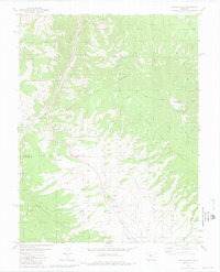
1980 Map of Poncha Pass
USGS Topo · Published 1981About this map
Poncha Pass serves as the central geographic anchor for this 1980 survey of the border between Chaffee and Saguache counties. The landscape is defined by the high-elevation drainage divide between Poncha Creek, flowing north, and San Luis Creek, winding south toward the San Luis Valley. This map provides a detailed view of the regional transportation history, most notably the winding path of the Old Railroad Grade and the Marshall Pass Road as they navigate the steep grades near Mearx Junction. Evidence of the area's resource extraction is scattered throughout the terrain, with numerous prospects and quarries dotting the slopes of Poncha Mountain and Cleveland Mountain. The intersection of the San Isabel National Forest and Rio Grande National Forest highlights the managed nature of this mountainous corridor during the late twentieth century.
Find a feature on this map
39 named features on this map. Tap any name to fly to it.
Don’t see what you’re looking for? This feature index may not catch every label — zoom into the map to look around manually.
Map Details
Editions of this 1980 Poncha Pass Map
4 editions found
Other maps of this area

1954 · Pueblo
USGS Topo · 1:250,000

1956 · Cameron Mountain
USGS Topo · 1:62,500

1956 · Poncha Springs
USGS Topo · 1:62,500

1956 · Montrose
USGS Topo · 1:250,000

1957 · Pueblo
USGS Topo · 1:250,000

1958 · Pueblo
USGS Topo · 1:250,000

1959 · Montrose
USGS Topo · 1:250,000

1959 · Bonanza
USGS Topo · 1:62,500

1959 · Howard
USGS Topo · 1:62,500

1960 · Montrose
USGS Topo · 1:250,000