
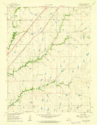
1961 Map of Pontiac
USGS Topo · Published 1962About this map
Lake Bluestem anchors the northwestern corner of this prairie landscape, where the waters of Bemis Creek and Harrison Creek are gathered. The terrain is defined by the headwaters of the Walnut River system, including the Middle Branch Walnut River and Bird Creek. Settled life is concentrated along the Missouri Pacific railroad, which passes through the community of Pontiac. This village is supported by a local Townhall and the nearby Pontiac Cem.
Find a feature on this map
24 named features on this map. Tap any name to fly to it.
Don’t see what you’re looking for? This feature index may not catch every label — zoom into the map to look around manually.
Map Details
Editions of this 1961 Pontiac Map
This is the sole edition of this map. No revisions or reprints were ever made.
Other maps of this area

1888 · Eldorado
USGS Topo · 1:125,000

1955 · Wichita
USGS Topo · 1:250,000

1958 · Wichita
USGS Topo · 1:250,000

1961 · De Graff
USGS Topo · 1:24,000

1961 · Rosalia NE
USGS Topo · 1:24,000

1961 · El Dorado
USGS Topo · 1:24,000

1961 · Rosalia
USGS Topo · 1:24,000
1961 · Rosalia NW
USGS Topo · 1:24,000

1963 · Leon
USGS Topo · 1:24,000

1964 · Beaumont
USGS Topo · 1:24,000