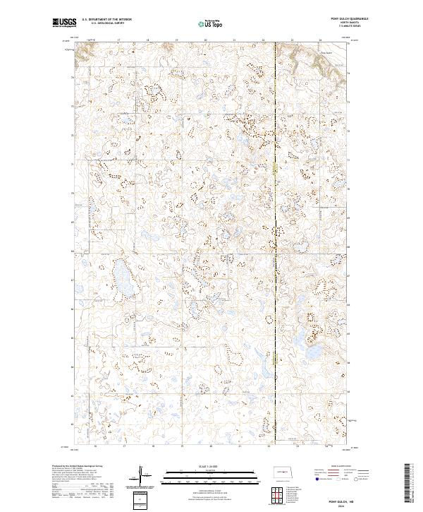
2024 Map of Pony Gulch
USGS Topo · Published 2024About this map
Pony Gulch defines the undulating prairie landscape of central North Dakota, where the boundary between Sheridan Co and Wells Co divides a vast network of wetlands and potholes. This modern topographic survey reveals the intricate hydrography of the region, specifically preserved within the Wells County Waterfowl Production Area and the Sheridan County Waterfowl Production Area. The landscape is organized by a rigid grid of rural section roads, including 14th St NE and 20th Ave NE, which provide access to the isolated farmsteads and conservation tracts. The map serves as a primary reference for the Public Land Survey System, clearly delineating townships such as t147n r74w and t147n r73w, reflecting the enduring homestead-era land divisions that continue to shape the Dakotas today.
Find a feature on this map
25 named features on this map. Tap any name to fly to it.
Don’t see what you’re looking for? This feature index may not catch every label — zoom into the map to look around manually.
Map Details
Editions of this 2024 Pony Gulch Map
This is the sole edition of this map. No revisions or reprints were ever made.
Other maps of this area

1945 · Manfred
USGS Topo · 1:62,500

1946 · Sheyenne Lake
USGS Topo · 1:48,000

1947 · Sheyenne Lake
USGS Topo · 1:62,500

1948 · Manfred
USGS Topo · 1:62,500

1949 · Manfred SW
USGS Topo · 1:24,000

1950 · Manfred NW
USGS Topo · 1:24,000

1950 · Sheyenne Lake NE
USGS Topo · 1:24,000

1950 · Sheyenne Lake
USGS Topo · 1:24,000

1950 · Manfred SW
USGS Topo · 1:24,000

1952 · New Rockford
USGS Topo · 1:250,000