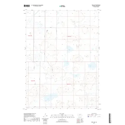
2017 Map of Pony Lake
USGS Topo · Published 2017About this map
Eureka Valley Cem sits in a high, isolated position amidst the distinctive kettle-and-wetland topography of Rock County. This landscape is defined by its numerous named basins, ranging from the central Goose Lake and Wolf Lake to the more distant Snipe Lake and Pony Lake. The drainage network is sparse, with Dry Cr and the S Fork Elkhorn River cutting through the northern reaches of the quadrangle.
Find a feature on this map
25 named features on this map. Tap any name to fly to it.
Don’t see what you’re looking for? This feature index may not catch every label — zoom into the map to look around manually.
Map Details
Editions of this 2017 Pony Lake Map
This is the sole edition of this map. No revisions or reprints were ever made.
Other maps of this area

1954 · Stuart
USGS Topo · 1:24,000

1954 · Newport
USGS Topo · 1:24,000

1954 · Newport SW
USGS Topo · 1:24,000

1955 · O'Neill
USGS Topo · 1:250,000

1959 · O'Neill
USGS Topo · 1:250,000

1969 · O'Neill
USGS Topo · 1:250,000
1982 · Linke Lake
USGS Topo · 1:24,000

1982 · Stockdale Lake
USGS Topo · 1:24,000

1982 · Sybrant
USGS Topo · 1:24,000

1982 · Dora Lake
USGS Topo · 1:24,000