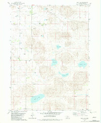
1982 Map of Pony Lake
USGS Topo · Published 1982About this map
Pony Lake and a series of distinct water bodies dominate this portion of the Nebraska Sandhills, reflecting a landscape defined by its hydrology and ranching heritage. The presence of the Pony Lake Sch and the Eureka Valley Cem indicates a established rural community structured around these natural basins. Numerous flowing wells are mapped across the terrain, vital for the operations of local sites like Arrowsmith Ranch, Stewart Ranch, and Peterson Ranch. The Elkhorn River cuts through the northwest corner, while internal drainage feeds a chain of lakes including Goose Lake, Wolf Lake, Otter Lake, and Snipe Lake. This map captures the intersection of natural Nebraska wetlands and the ranching families who managed this unique environment in the late twentieth century.
Find a feature on this map
17 named features on this map. Tap any name to fly to it.
Don’t see what you’re looking for? This feature index may not catch every label — zoom into the map to look around manually.
Map Details
Editions of this 1982 Pony Lake Map
This is the sole edition of this map. No revisions or reprints were ever made.
Other maps of this area

1954 · Stuart
USGS Topo · 1:24,000

1954 · Newport
USGS Topo · 1:24,000

1954 · Newport SW
USGS Topo · 1:24,000

1955 · O'Neill
USGS Topo · 1:250,000

1959 · O'Neill
USGS Topo · 1:250,000

1969 · O'Neill
USGS Topo · 1:250,000
1982 · Linke Lake
USGS Topo · 1:24,000

1982 · Stockdale Lake
USGS Topo · 1:24,000

1982 · Sybrant
USGS Topo · 1:24,000

1982 · Dora Lake
USGS Topo · 1:24,000