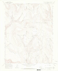
1967 Map of Pool Table Mountain
USGS Topo · Published 1969About this map
Rio Grande National Forest high country dominates this landscape, where the La Garita Mountains define the high-altitude terrain of Mineral, Saguache, and Rio Grande counties. The 1967 field check illustrates a remote territory managed for transit and timber, centered on the prominent Pool Table Mountain (Little Pool). The presence of specialized infrastructure like the La Garita Stock Driveway and the Alder Stock Driveway provides an insight-gain into the era's seasonal livestock migrations through the mountains. Numerous high-alpine basins, locally referred to as parks, are scattered throughout the quadrangle, including Viers Park, Blue Park, and Long Park. Drainage networks are complex, with headwaters such as Bellows Creek, Embargo Creek, and the glacial-carved Cañon Nieve feeding into the larger Rio Grande basin. This survey documents the intersection of several county boundaries in a region defined by its wilderness status and historic stock routes.
Find a feature on this map
46 named features on this map. Tap any name to fly to it.
Don’t see what you’re looking for? This feature index may not catch every label — zoom into the map to look around manually.
Map Details
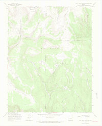
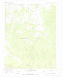
Editions of this 1967 Pool Table Mountain Map
3 editions found
Other maps of this area

1914 · Creede
USGS Topo · 1:125,000

1916 · Creede
USGS Topo · 1:125,000

1945 · Durango
USGS Topo · 1:250,000

1953 · Durango
USGS Topo · 1:250,000

1954 · Durango
USGS Topo · 1:250,000

1957 · Spar City
USGS Topo · 1:62,500

1959 · Creede
USGS Topo · 1:62,500

1961 · Durango
USGS Topo · 1:250,000

1963 · Durango
USGS Topo · 1:250,000

1966 · Durango
USGS Topo · 1:250,000