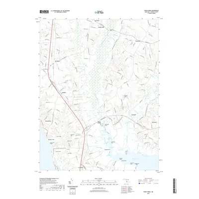
2019 Map of Popes Creek
USGS Topo · Published 2019About this map
Zekiah Swamp dominates the central geography of this southern Charles County landscape, where the Zekiah Swamp Run winds south toward the Wicomico River. The 2019 survey documents a region defined by its colonial-era legacy and traditional Chesapeake maritime connections, anchored by settlements like Newport and Bel Alton. Along the western edge, US Highway 301 serves as a primary corridor through Faulkner and Newburg, while the Potomac Heritage National Scenic Trail traces a path for modern travelers through the historic terrain. Genealogists and local historians can locate long-standing community landmarks such as Saint Marys Catholic Church Cem near Herbert Run and family-named sites like Rogers Mill. The map also captures the intricate coastline of the lower Wicomico, identifying points such as Cooksey Point, Carpenter Point, and McReynolds Point alongside the marshy inlets of Foggy Bottoms.
Find a feature on this map
73 named features on this map. Tap any name to fly to it.
Don’t see what you’re looking for? This feature index may not catch every label — zoom into the map to look around manually.
Map Details
Editions of this 2019 Popes Creek Map
This is the sole edition of this map. No revisions or reprints were ever made.
Other maps of this area

1889 · Fredericksburg
USGS Topo · 1:125,000

1890 · Mt. Vernon
USGS Topo · 1:125,000

1891 · Mt. Vernon
USGS Topo · 1:125,000

1892 · Fredericksburg
USGS Topo · 1:125,000

1892 · Brandywine
USGS Topo · 1:62,500

1894 · Wicomico
USGS Topo · 1:62,500

1894 · Fredericksburg
USGS Topo · 1:125,000

1894 · Mt. Vernon
USGS Topo · 1:125,000

1895 · Wicomico
USGS Topo · 1:62,500

1895 · Brandywine
USGS Topo · 1:62,500