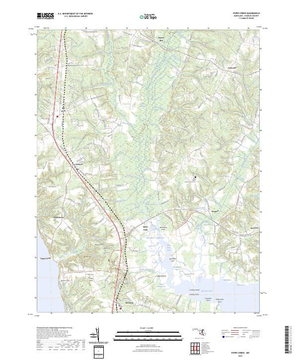
2023 Map of Popes Creek
USGS Topo · Published 2023About this map
Zekiah Swamp and the dense network of tributaries feeding the Wicomico River define the terrain of southern Charles County. This landscape is a complex of wetlands and tidal guts, including Fresh Marsh, Tears Gut, and Steinhauser Gut. The settlement pattern follows the higher ground and major road corridors like US Highway 301, connecting rural crossroads such as Bel Alton, Faulkner, and Allens Fresh.
Find a feature on this map
73 named features on this map. Tap any name to fly to it.
Don’t see what you’re looking for? This feature index may not catch every label — zoom into the map to look around manually.
Map Details
Editions of this 2023 Popes Creek Map
This is the sole edition of this map. No revisions or reprints were ever made.
Other maps of this area

1889 · Fredericksburg
USGS Topo · 1:125,000

1890 · Mt. Vernon
USGS Topo · 1:125,000

1891 · Mt. Vernon
USGS Topo · 1:125,000

1892 · Fredericksburg
USGS Topo · 1:125,000

1892 · Brandywine
USGS Topo · 1:62,500

1894 · Wicomico
USGS Topo · 1:62,500

1894 · Fredericksburg
USGS Topo · 1:125,000

1894 · Mt. Vernon
USGS Topo · 1:125,000

1895 · Wicomico
USGS Topo · 1:62,500

1895 · Brandywine
USGS Topo · 1:62,500